![]()

![]()

![]()
Why Just Go........When You Can RunO
![]()
|
Why Just Go........When You Can RunO |
|||
| www.RunO.dk - Home | |||
|
|
|||
| Type | Map | Comments | Map | ||||
| Type | Kort | Kommentar | Kort | ||||
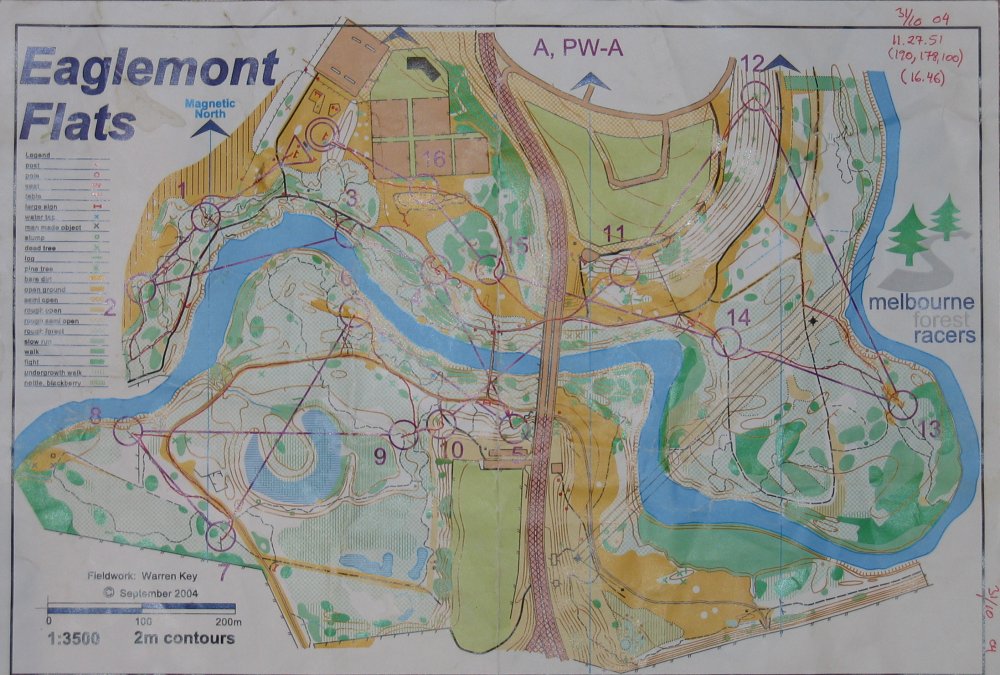
| Training | Eaglemont Flats | Good little forest area when it not to wet, as it gets flooded | Map | ||||
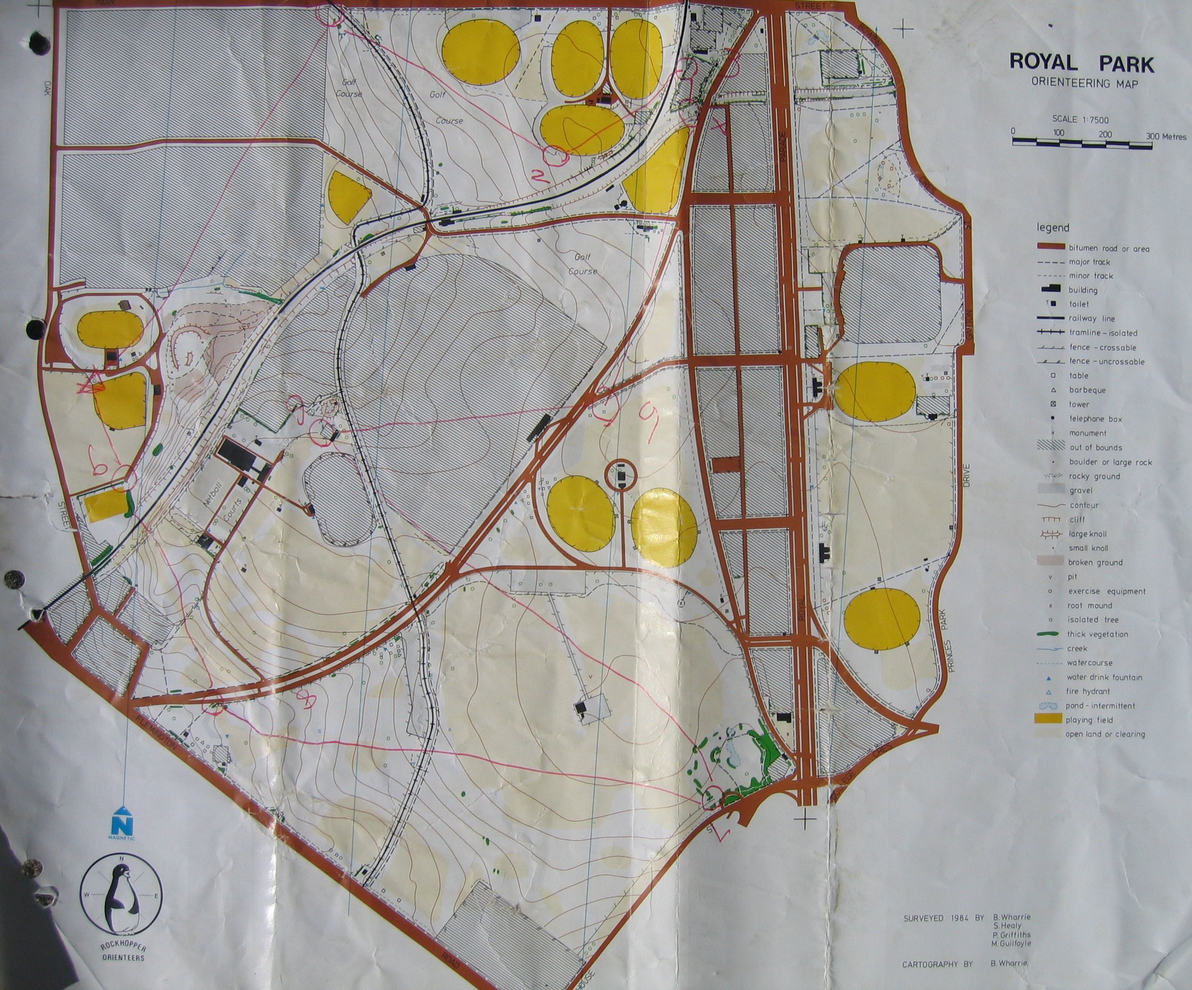
| Training | Royal Park | Map | |||||
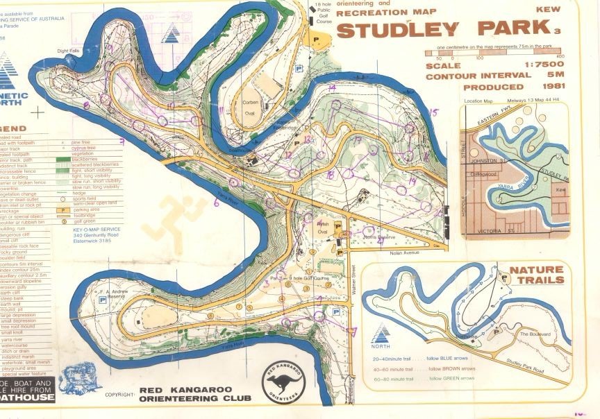
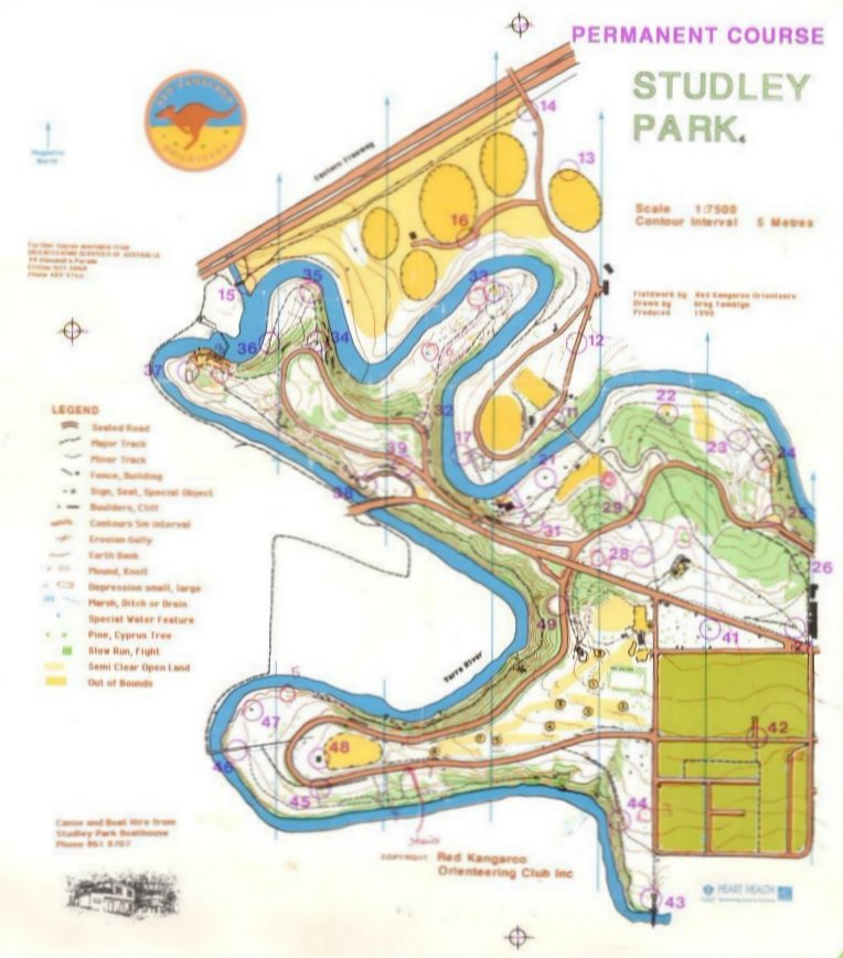
| Training | Studley Park | 6 k from city and with some good paths along the Yarra | Map , Map | ||||
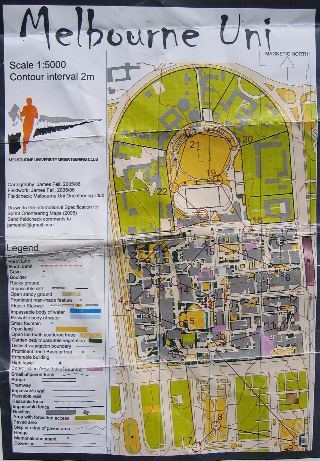
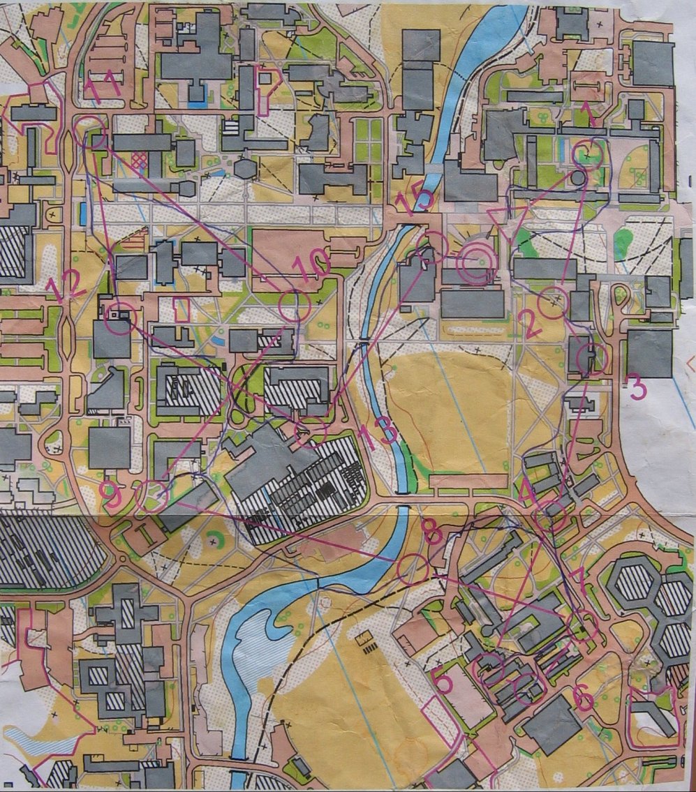
| Sprint training | Melbourne Uni | New | Sprint O map | Map | |||
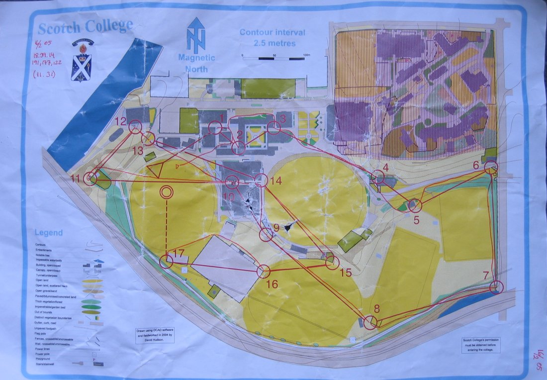
| Sprint training | Scotch College | Sprint O map | Map | ||||
| Sprint training | Westgate Park | Sprint O map | Map | ||||
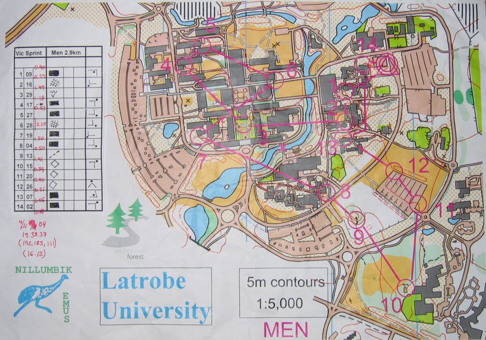
| Sprint training | La Trobe Uni | Sprint O map | Map | ||||
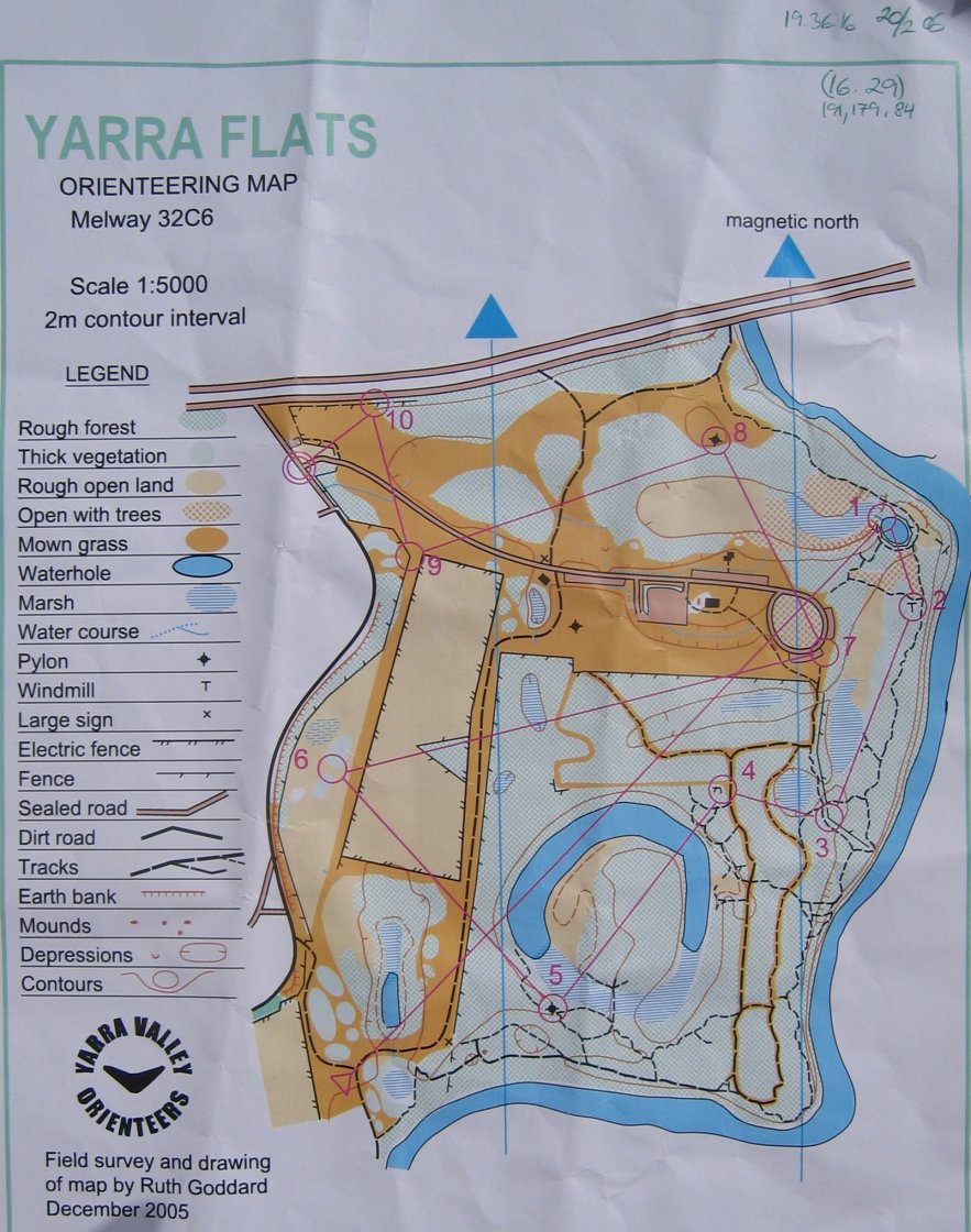
| Sprint training | Yarra Flats | New | Sprint O map | Map | |||
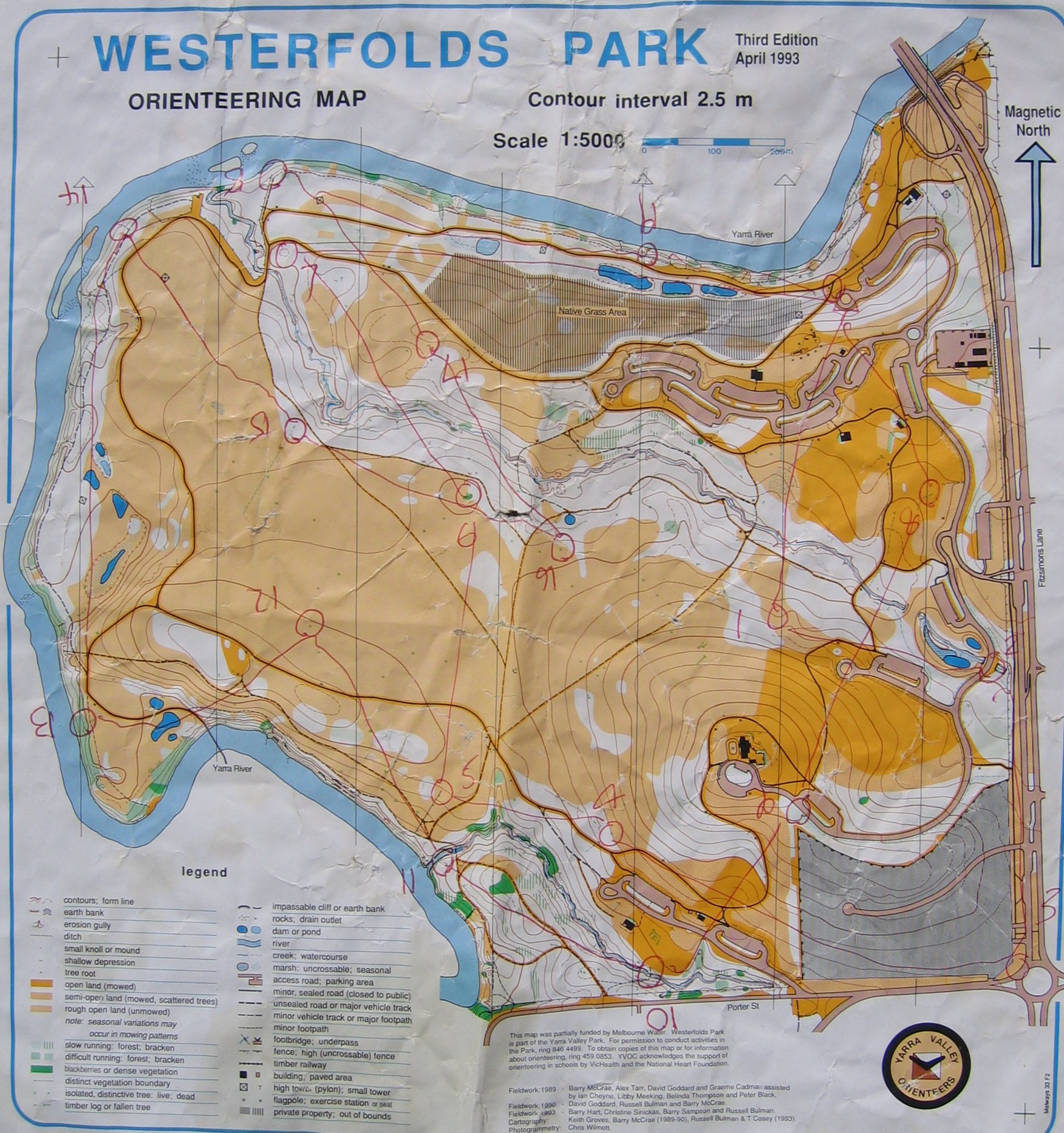
| Sprint training | Westfold Park | Sprint O map | Map | ||||
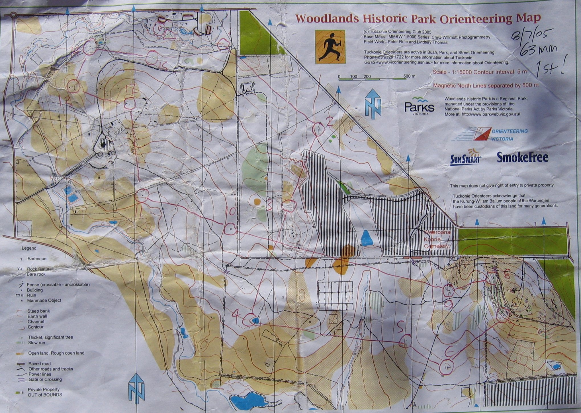
| Orieenteering | Woodlands Historic park | Bush/sprint O map | Map | ||||
|
Terrain Loop Terræn runde |
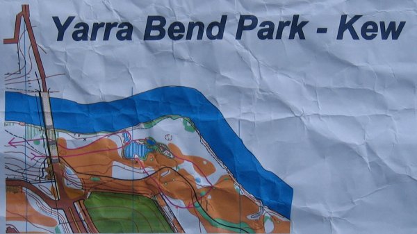
Yarra Bend Park |
7 k from city, with good small paths and
some hills. Terrain Loop (terrænrunde) |
Map part 1 Map part 2 |
||||
| Lunch run Frokost jog |
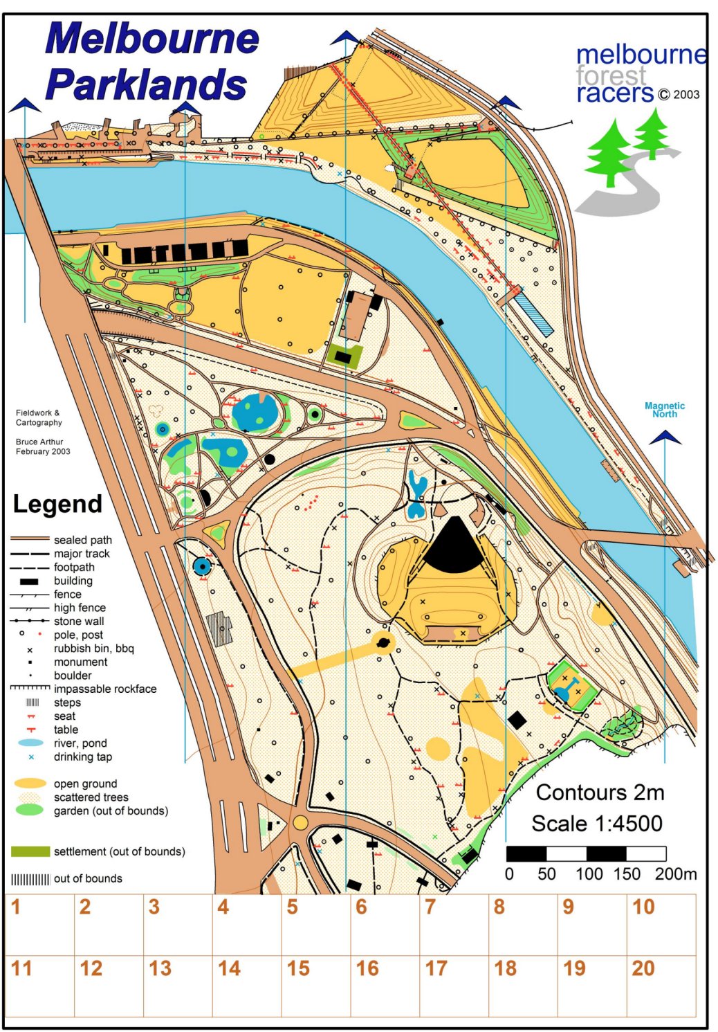
The Tan | New | Melbourne Botanic
Garden, bare 5 min jog fra PwC Freshwaterplace The most popular place to go for a jog, 3,8 k of gravel track. |
Map | |||
| Type | Map | Comments | Map | ||||
| Type | Kort | Kommentar | Kort | ||||
|
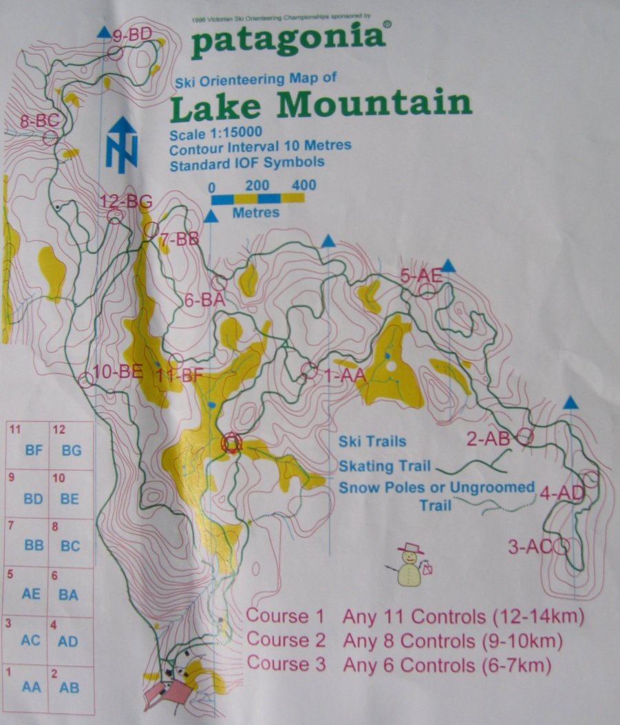
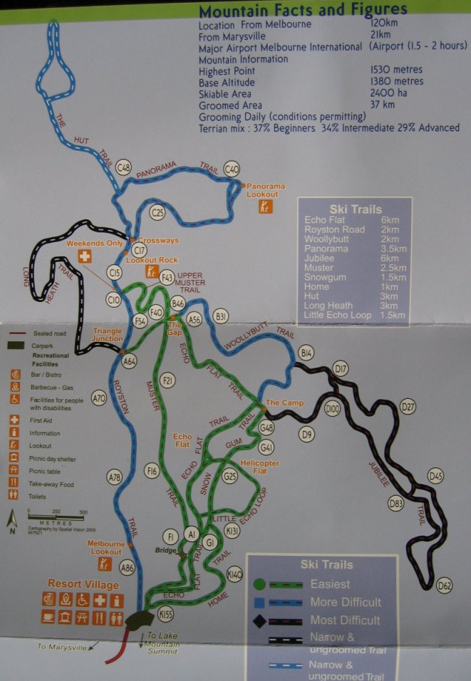
Cross Country ski Langrend |
Lake Mountain | Cross Country ski area only 2 hours east of City (120 km) with a total of 37 k slopes. | Map , Map | ||||
|
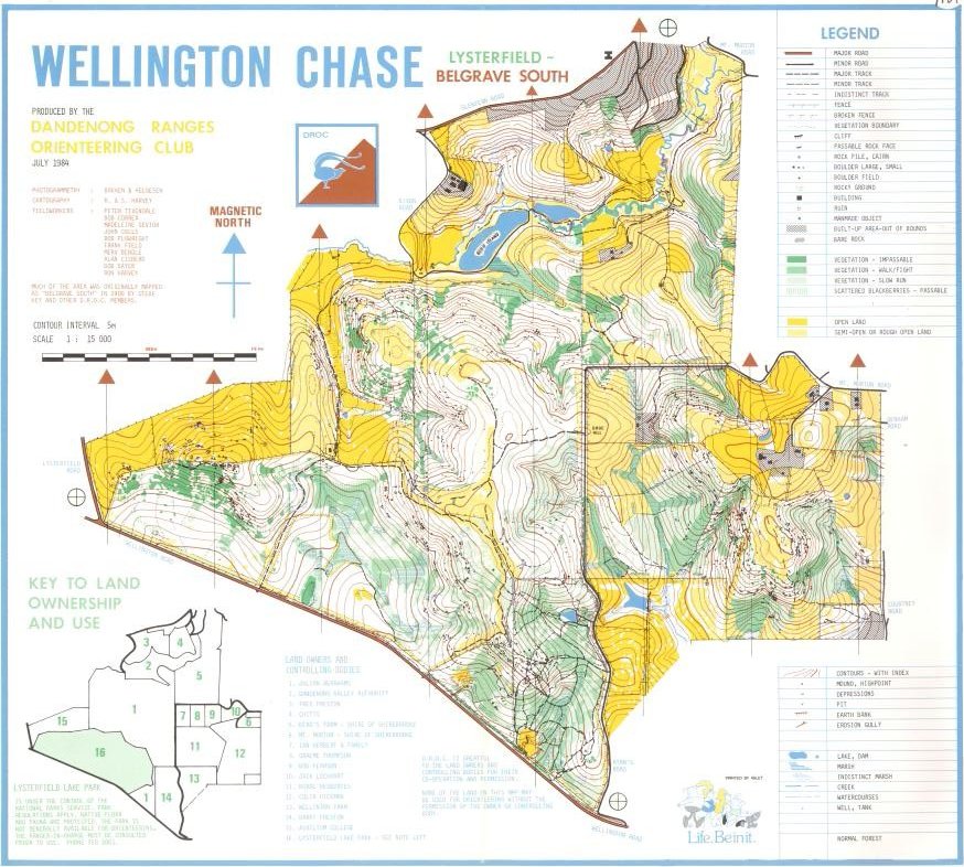
Hill Loop Bakketur |
Lysterfield | The moderat hilled area is to be used for the MTB races for the Commonwealth Games 2006 | North , South | ||||
|
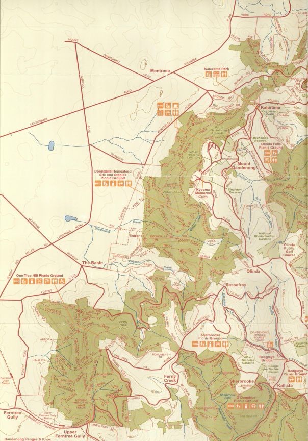
Hill Loop Bakketur |
Mt. Dandenong | Dandenong ranges east 45 min east of City | Map | ||||
|
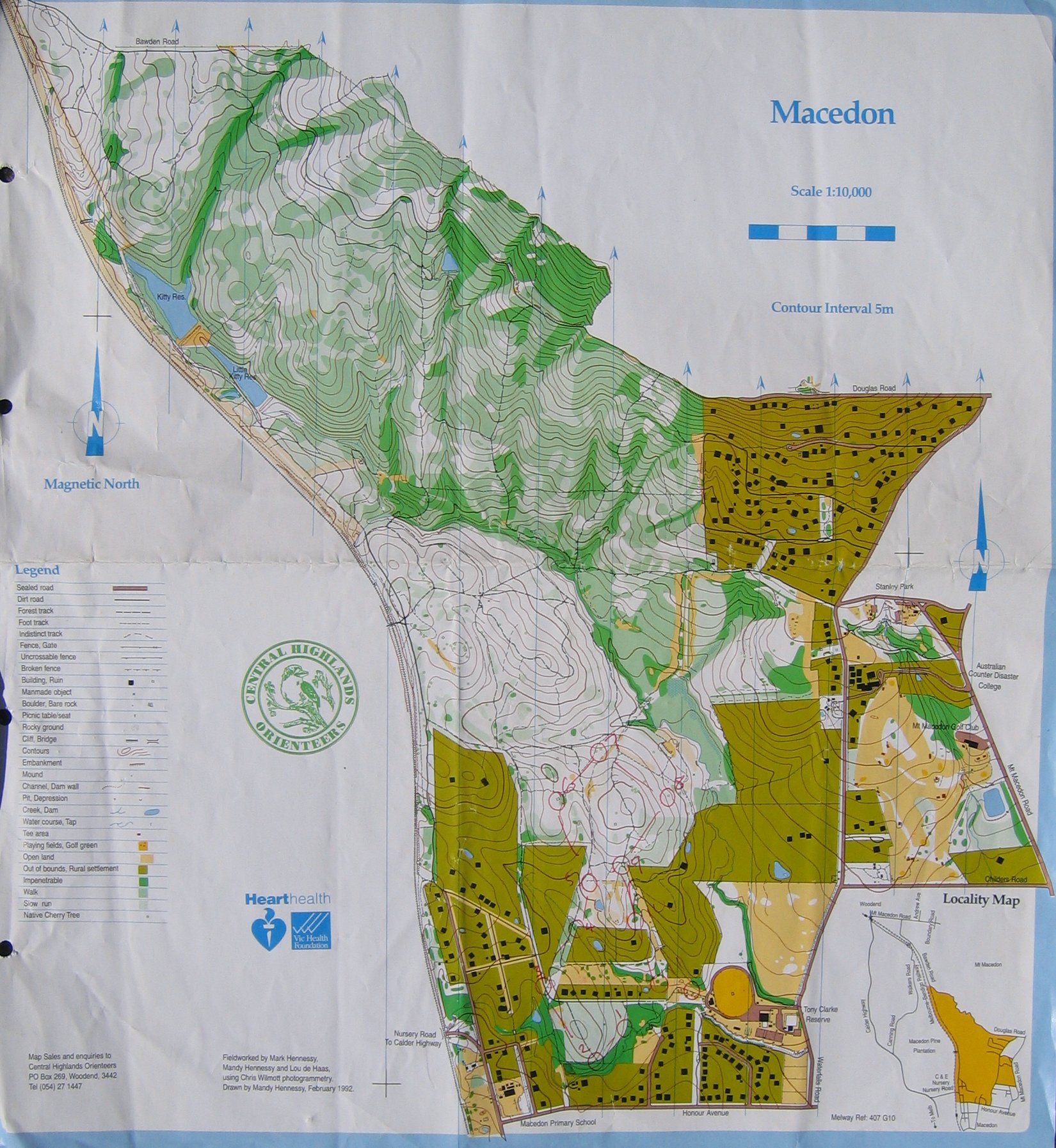
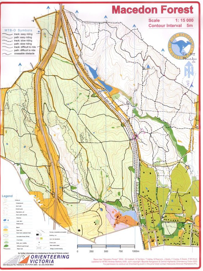
Hill Loop Bakketur |
Mt. Macedon | Troysi's homeground about one hour drive north of Melbourne | Map , Map | ||||
| Type | Map | Comments | Map | ||||
| Type | Kort | Kommentar | Kort | ||||
| Sprint | Canberra Uni (ACT) | New | Map | ||||
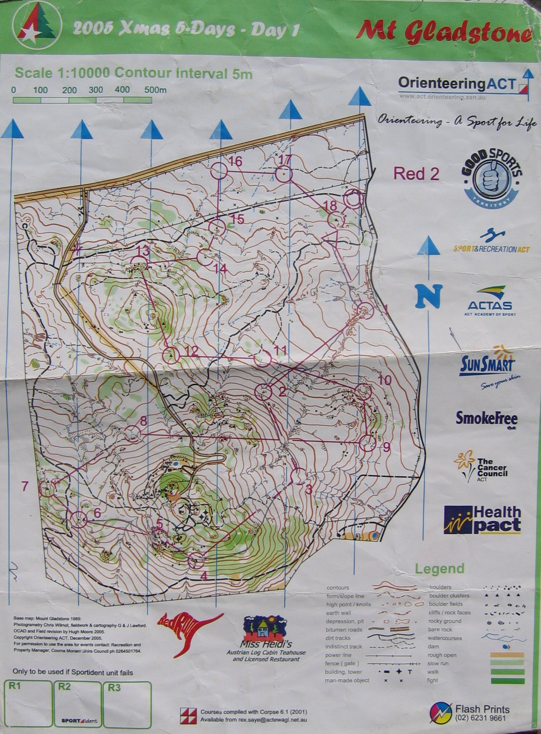
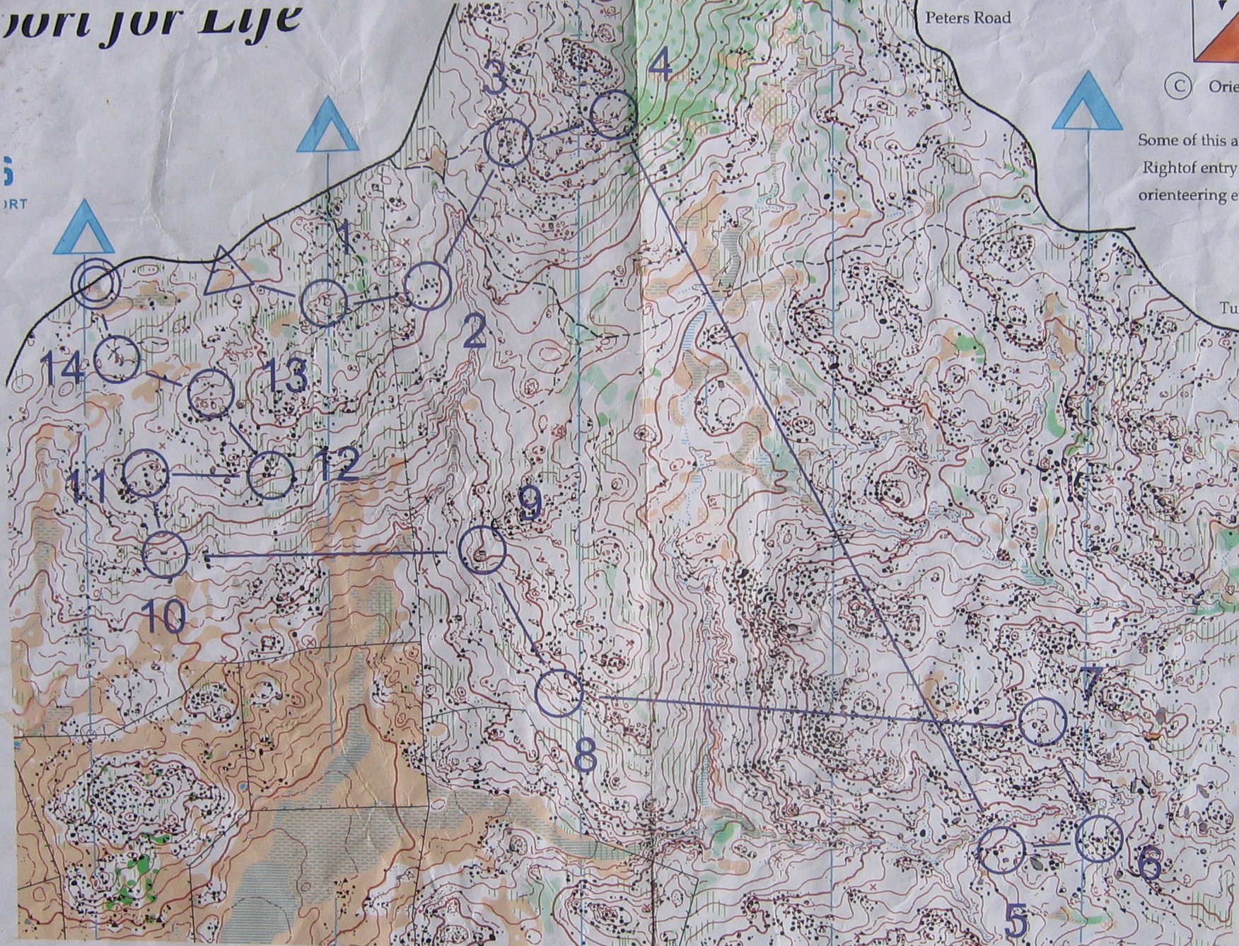
| Bush | Mt Gladstone (NSW) | New | Map | ||||
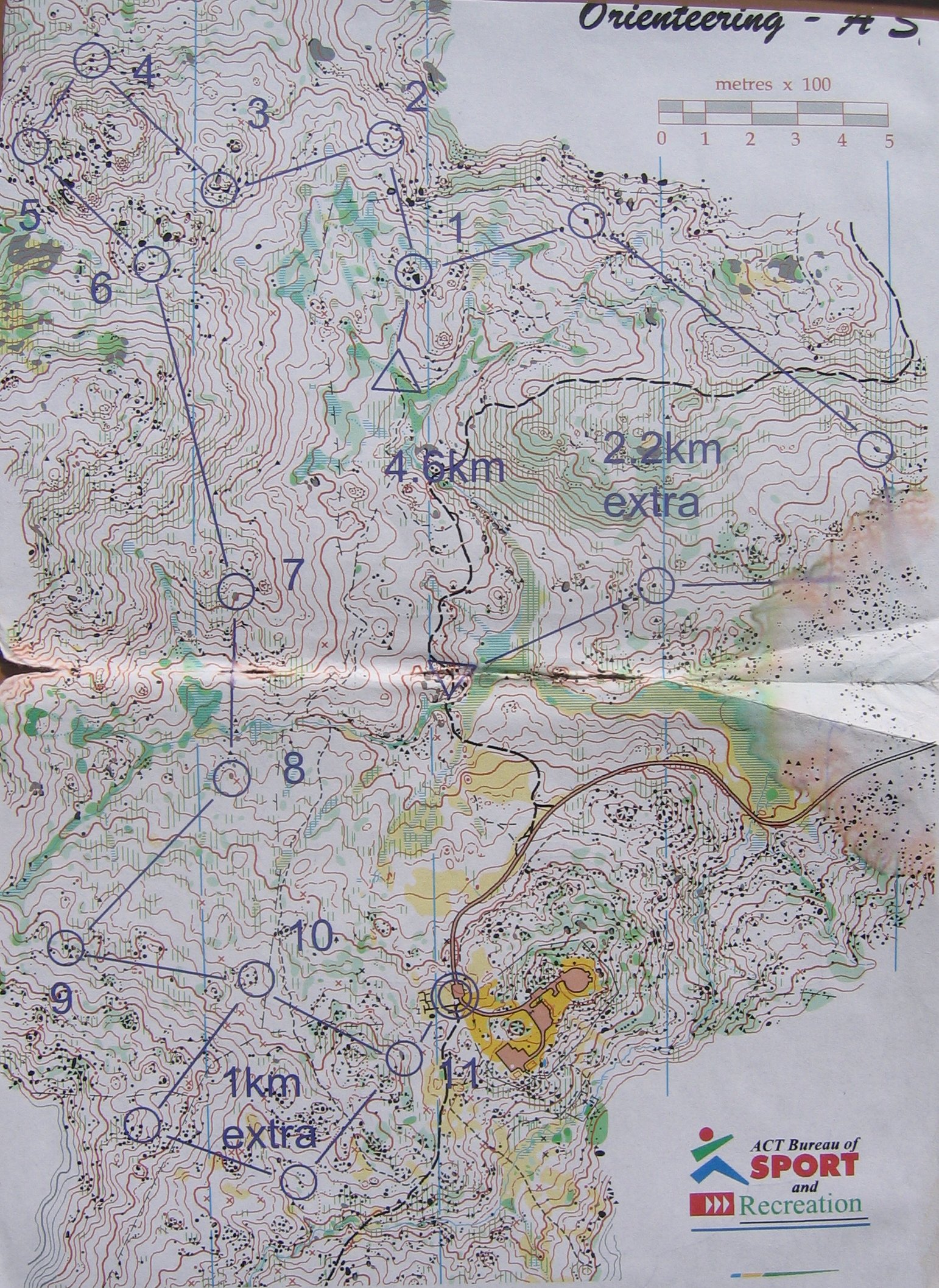
| Bush | ACT | New | Used for WC in Australia |
Map Map |
|
The Orienteering is cancelled! What am I going to do? May you spike all your controls when you go Orienteering! |